Each time we arrived at a new site in Egypt, almost every guide would say it with confidence:
“We never used slavery for construction. The workers were paid. The records confirm it.”
And perhaps—very often—that is true.
Still it was surprising to hear—especially when the kings of Egypt so readily boast in their inscriptions of military conquests, portraying foreign nations with bound arms, led away in submission.
The pictography from the tomb of Rameses IV. Valley of the Kings. Egypt.
And yet—Scripture speaks differently of a certain period in time in Egypt history like hard, crushing labor עֲבֹדָה קָשָׁה (avodah kashah) in the house of bondage” (בֵּית עֲבָדִים) (Ex 20:2)
I was asked how it can be that Scripture seems to give different timeframes for the bondage in Egypt.
At first reading, it does feel like Scripture is giving us three different numbers:
1. “Know surely that your seed will be a stranger in a land not theirs, and they will enslave them and afflict them four hundred years.” Genesis 15:13
Stephen in New Testament is referring to this promise:
“And God spoke in this way, that his seed would be sojourning in a foreign land, and they would enslave them and mistreat them four hundred years.” Acts 7:6
2. “And the sojourning of the children of Israel, which they dwelt in Egypt, was four hundred and thirty years. Ex.12:41
3. “But in the fourth generation they shall return here (about 200 years) Gen. 15:16.
Let us walk through it carefully.
Do you remember that in Gen. 12 Abraham receives the vision often called the “covenant between the pieces.” Only later in Gen 15:13 God inform Abraham, ‘Know surely that your seed will be a stranger in a land not theirs, and they will enslave them and afflict them four hundred years.’”
The verse does not say, “You will be in Egypt for 400 years.”
It says, “your seed will be a stranger.”
So the count cannot begin at the moment of the vision, because at that moment Abraham still has no seed. The countdown begins only when the promised Isaak begins to live as a “stranger, sojourner” גֵּר (ger), because the land is promised but not yet possessed.
In Galatians 3:17 Paul also speaks of 430 years—
not as years of slavery, but as the span from “promise between the pieces” to Sinai.
Please bear with me for a few more lines of biblical math.
Isaac was 60 years old when Jacob was born. (Gen. 25:26)
Jacob was 130 years old when he entered Egypt. (Gen. 47:9)
From Isaac’s birth to Jacob’s descent into Egypt:
60 + 130 = 190 years
Now let’s return to the 400 years of affliction:
400 − 190 = 210 years in Egypt (from Jacob’s descent to the Exodus)
After all, this isn’t trigonometry… is it? Scripture is not counting one single thing—it is describing different layers of the same unfolding story.
And exactly this math according to the Jews tradition was misunderstood by Ephraim tribe, who occupied a privileged territory in Egypt due to the fathers high position.
In 1 Chronicles 7:21–22 we read:
“The men of Gath who were born in the land came down and killed them…
And Ephraim their father mourned many days…”
Later Jewish sages expand this into a fuller story, which to be honest doesn’t withstand a proper exegetical reading.
According to this tradition, the descendants of Ephraim calculated the 400 years mentioned in Genesis 15:13 incorrectly. They began counting from the time of the promise instead of from the birth of Isaac. As a result, they believed the time of redemption had arrived about 30 years too early and made a public primature exodus. Tradition speaks of some 200,000 men who set out, leaving their brethren behind.
They chose the northern short trade route the "Way of th Philistines", the direct road toward Canaan.
When they reached the region of Gath, they encountered local forces and were defeated. The entire group was destroyed. This memory remained fresh among the people by the time of the Exodus. Hebrew sages later connected this with the fear of encountering the scattered dry bones of their brethren and losing heart—an image echoed in Ezekiel 37.
“When Pharaoh sent out the people,
God did not lead them (וְלֹא־נָחָם, ve-lo naḥam) by the way of the land of the Philistines, for it was near—
for God said:
‘Lest the people lead their mind back / turn back /change mind (יִנָּחֵם, yinnaḥem) (I wanted to show you the wordplay of the same root)
when they see war (מִלְחָמָה, milḥamah)—
the visible presence of military force: fortifications, soldiers, and readiness for conflict— and they return to Egypt.’ (Ex. 13:17)
Now how can we understand this verse in its proper historical and geographical context?
There was a well-established coastal corridor linking Egypt with the Levant, known in the Bible as the “Way of the Philistines”, while in Egyptian sources as the “Ways of Horus.”
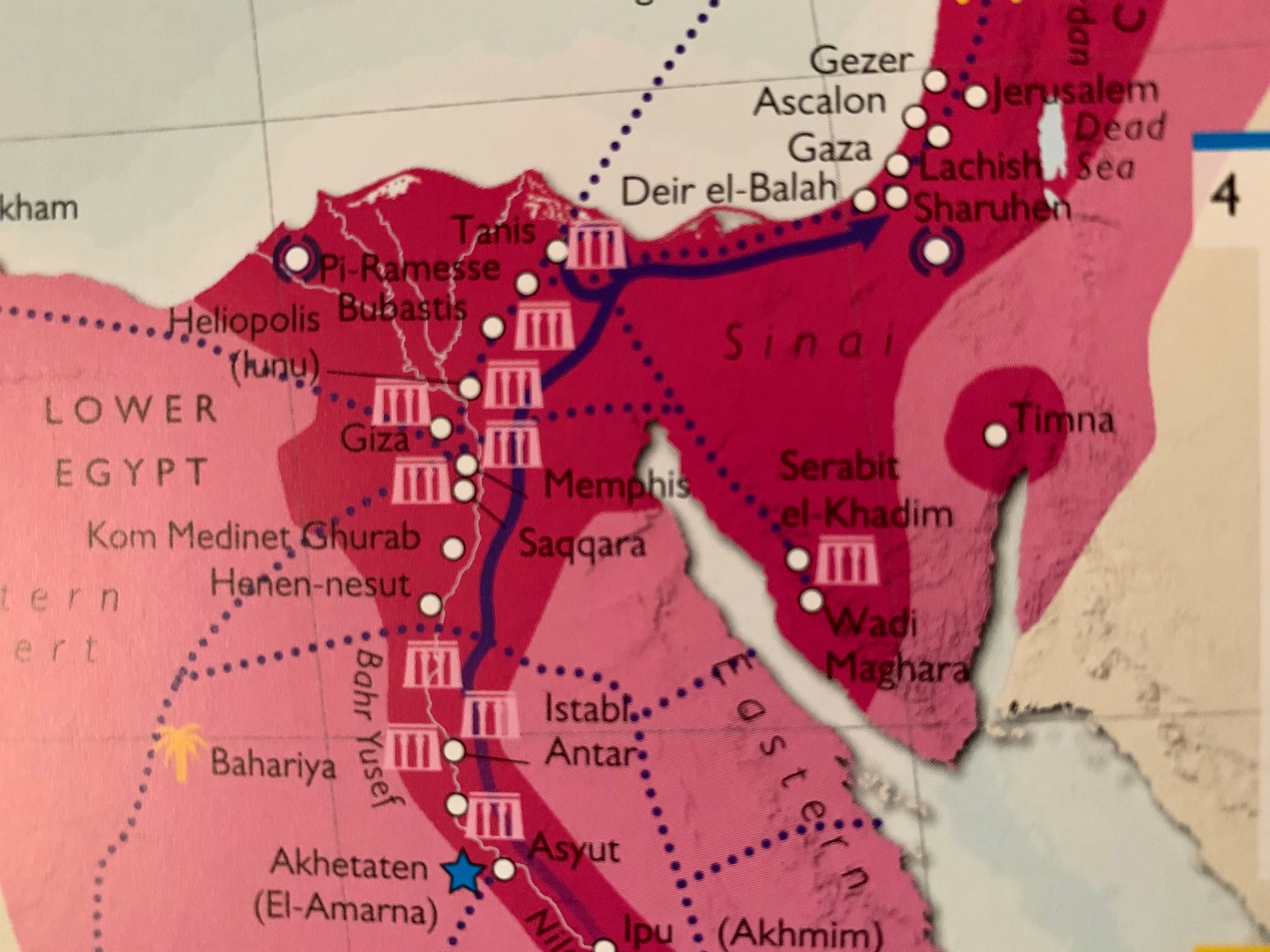
This was not a minor path but the principal international route between Africa and Asia. Running along the northern edge of the Sinai Peninsula, it followed the Mediterranean coastline toward Gaza and the southern Levant. In later classical geography it would be incorporated into what is often called the Via Maris, but already in the Late Bronze Age it functioned as a strategic artery for trade, diplomacy, and military campaigns.
Egyptian evidence shows that this road was highly organized and controlled. Reliefs from the reign of kings such as Seti I depict a chain of fortresses, wells, and supply stations. Archaeological work at sites like Tell el-Borg confirms this picture: installations were positioned near water sources and narrow passages between lagoons and marshes, making movement along the route visible and regulated.
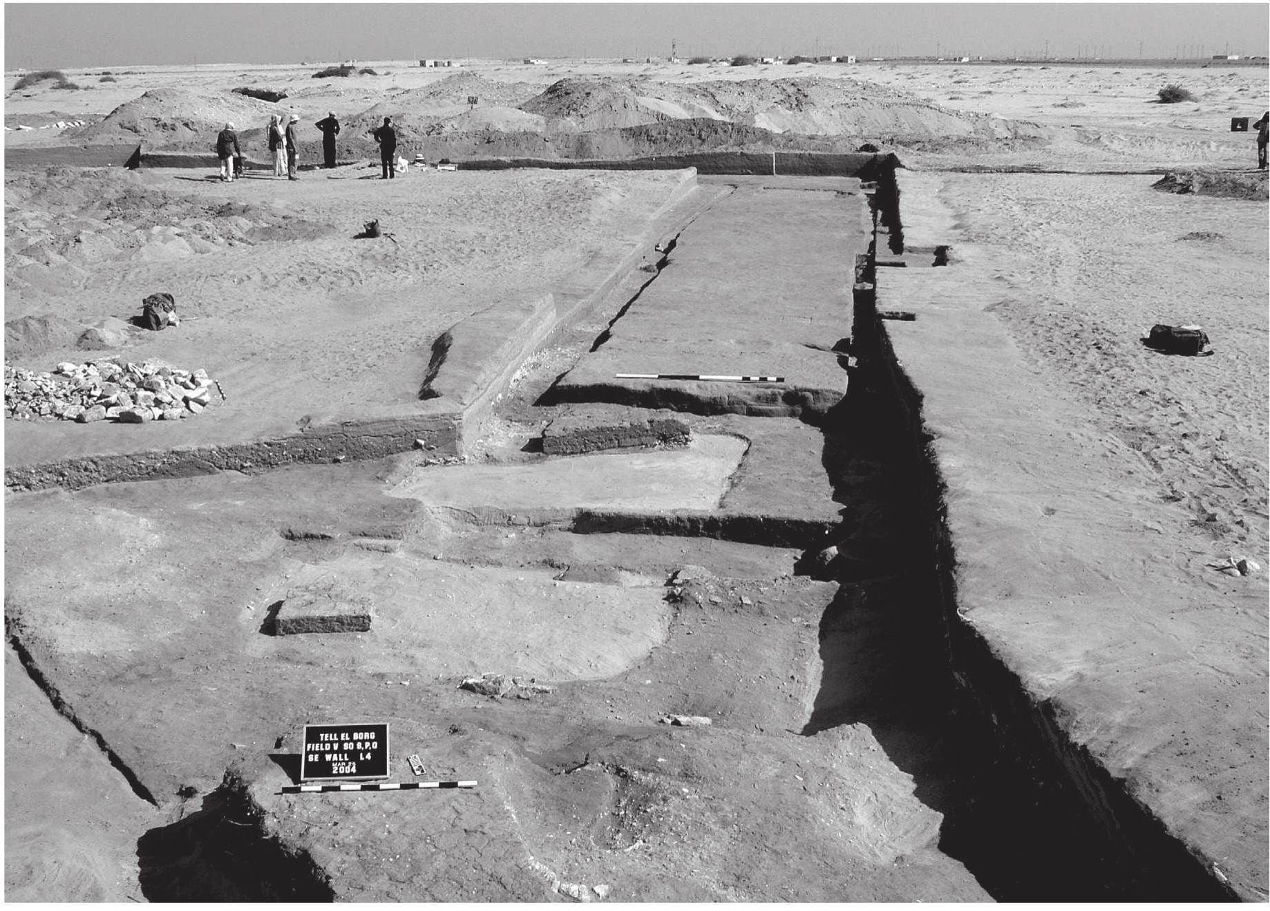
This system has been studied in detail by James K. Hoffmeier (Tell el-Borg I: Excavations in North Sinai, Eisenbrauns, 2014), who reconstructs the eastern frontier as a sequence of fortified stations. From west to east, the line likely included: Tjaru (Sile) as the main border gateway; Tell el-Borg, identified with the “Dwelling of Ramesses”; It is part of a chain of forts stretching from the Nile Delta to Gaza, positioned at intervals along the road. These checkpoints were linked visually and logistically, forming a continuous defensive and administrative chain.
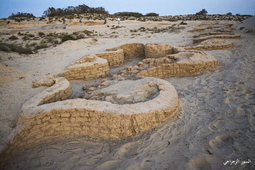
Geographically, the route was “near”—direct and efficient. It avoided the harsher interior of the Sinai Peninsula and provided access to water and infrastructure. But at the same time, it was also the most exposed and controlled path. Any large group of travellers (imagine 2.5 million people with cattle and herds) would inevitably encounter Egyptian border defences.
Egyptian reliefs sometimes depict not only forts, but also water reservoirs and tree-lined enclosures along the route—suggesting a carefully maintained corridor through a difficult landscape. What appears as a simple road was in fact a watched passage.
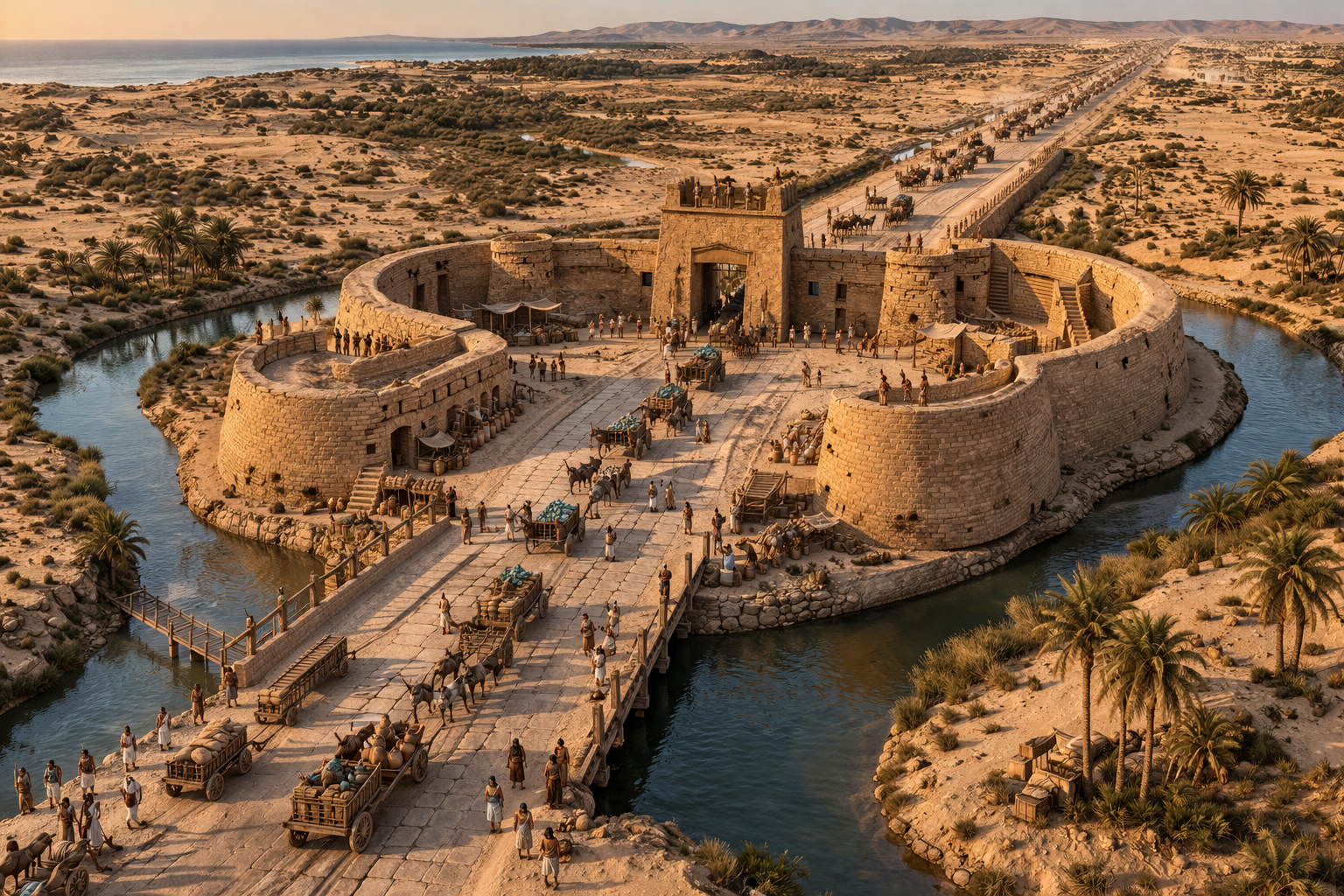
Now you can see what it would mean for a non-military, large population to take that route.
There is another route, slightly further south—much like an inland corridor, roughly corresponding to what is now known as desert Route 50, which leads toward the Gulf of Aqaba. Unlike the coastal highway, this was not a formal imperial road, but a network of inland paths shaped by wadis and natural corridors. It runs in the same direction, but further inland. That is the path the Lord has chosen for His people.
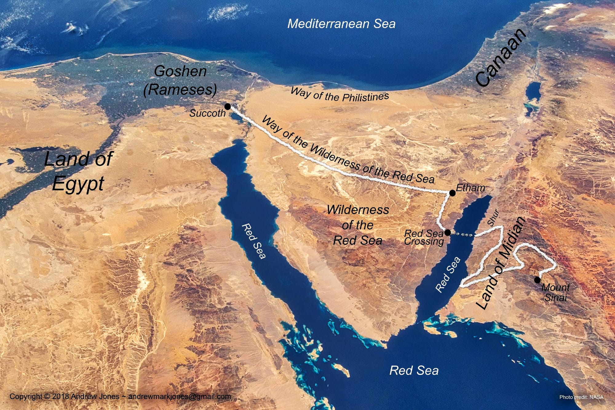
The question was never simply how to leave Egypt,
but how to become a people capable of not returning.
They left Egypt—
but Egypt had not yet left them.
The near road led through walls, watchtowers, and war.
The wilderness led through silence, dependence, and transformation.
One path was controlled by empire.
The other was path to be shaped by God.

Member discussion: